|
|
Home
Description
Conditions
Situation
Discoveries
Contact
|
Its situation, how to reach it.Adress: 44, chemin de Brinde - 84240 Ansouis. Aix en Provence is 30 km, Marseille and the sea 50 km, the TGV train station 30 minutes, the airport is 60 km, the beach of the charming Lake "La Bonde" is only 4 km.
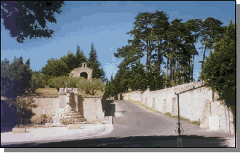
AccessibilityBy motorway coming from Lyon: A7 motorway, Senas exit, take left, Nationale 7 direction Nice/ Aix-en-Provence until the first roundabout (+ - 6km), take D23, direction of Mallemort/Mérindol/Pertuis until the next roundabout of “Bas-Iclons”, take D32 direction of Merindol/Pertuis. After having passed the bridge of the Durance, at the roundabout of D973 take it right, in the direction of Pertuis, continue for 15 km and pass the villages of Merindol, Lauris, Cadenet. Once at the roundabout of Villelaure, turn left direction of the village of Ansouis, At the entrance of the village, at the angle of the” place du lavoir”, take the road indicating the direction of the vineyard of St Estèphe de Neri. You pass a chapel on your left and after + - 800 m, take the first road on the right, just before a small bridge, (VC 101 Brinde). La Magnanerie is on the right side + - 50 m down the road. By the motorway coming from Marseilles or Aix-en-Provence: Take the A7/E712 for 3.5 km then take the direction Aix en Provence, Sisteron by A7/E712/E714 for 8 km, follow : Aix-en-Provence, Sisteron, Gap, leave this road towards N296/E712, continue for 6 km then take: A51/E712 for 11 km, direction Sisteron, Gap, leave at Exit 15, Pertuis.
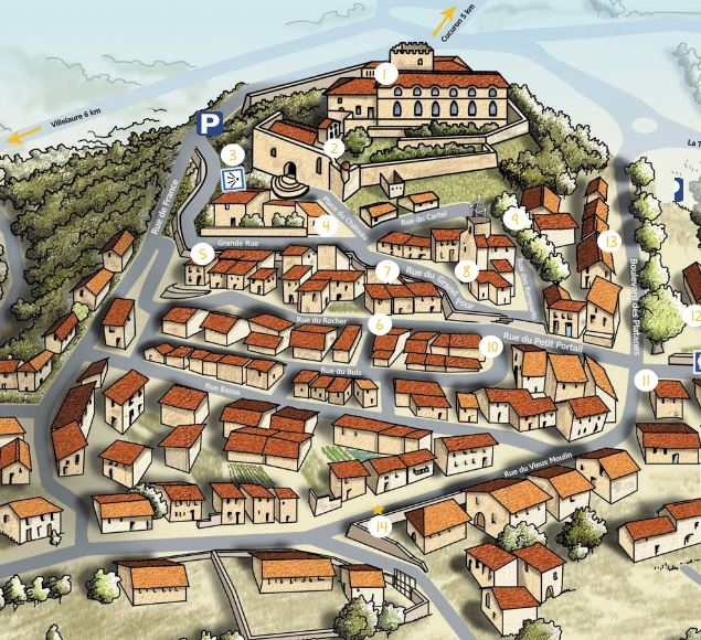
The Luberon natural parkAnsouis is located on the southern slope of the Luberon Regional Natural Park. Low mountain range (1125 m in Mourre Nègre) which extends from east to west between the Alpes-de-Haute-Provence and the Vaucluse and includes three «mountains»: the Eastern Luberon, the Grand Luberon and the Petit Luberon. The village
Located in the Luberon Regional Natural Park, Ansouis, at the foot of its medieval castle transformed over the centuries into a pleasure house, deploys its houses in a hemicycle on the slope of the hill protected from the mistral wind. The wonderfully preserved village is still dominated by its magnificent castle, former possession of the Sabran family. Before reaching it, you cross the main square and walk through the alleys with beautifully restored houses: the oldest date from the 15th and 17th centuries. The parish church of St Martin is even older: inside you can admire reliquary busts, wooden panels and a 17th century altarpiece. The castle, both a medieval stronghold and a 17th century bastide, has preserved a keep and fortress turrets, as well as ramparts with battlements and machicolations. The gardens are beautiful, decorated with carved boxwood and remarkably maintained. From the terrace, the view of the Ste Victoire mountain is superb. CommoditiesAnsouis has a supermarket VIVAL Casino, a bakery on the "place du lavoir" and many other useful services... Lourmarin and Cadenet are a few km from Ansouis. Cucuron, with its pond lined with splendid plane trees, is 5 km. In the town of Pertuis, 7 km, you will find a multitude of shops of all kinds, Hyper U, Carrefour, ... many of which are open on Sunday morning, as well as the weekly market of Ansouis.
Click on the image to download the information package in pdf format (French)
|
| © Michel Veriter - Layout by Svetainių kūrimas |